Key Takeaways
- A 12–24 hour shutdown leads to a backlog: vehicles needing transport keep increasing while trucks are parked.
- Expect 24-48 hour delays for vehicles already in transit.
- Expect 2-4 day delays for vehicles waiting for pickup after the storm.
A Winter Storm Warning covering 11 southeastern Wisconsin counties: Milwaukee, Waukesha, Ozaukee, Washington, Kenosha, Racine, Walworth, Jefferson, Sheboygan, Dodge, and Fond du Lac goes into effect early tomorrow morning, Saturday, November 30, 2024.
It is expected to bring 6-10 inches of snow to the Chicago-Milwaukee auto transport corridor. The National Weather Service upgraded the warning overnight, with meteorologists projecting peak snowfall rates of one inch per hour during Saturday afternoon.
This storm will affect almost all major interstate routes used by vehicle carriers in southeastern Wisconsin such as:
- I-94
- I-43
- I-41
Wind gusts reaching 40-45 mph will create blowing and drifting snow.
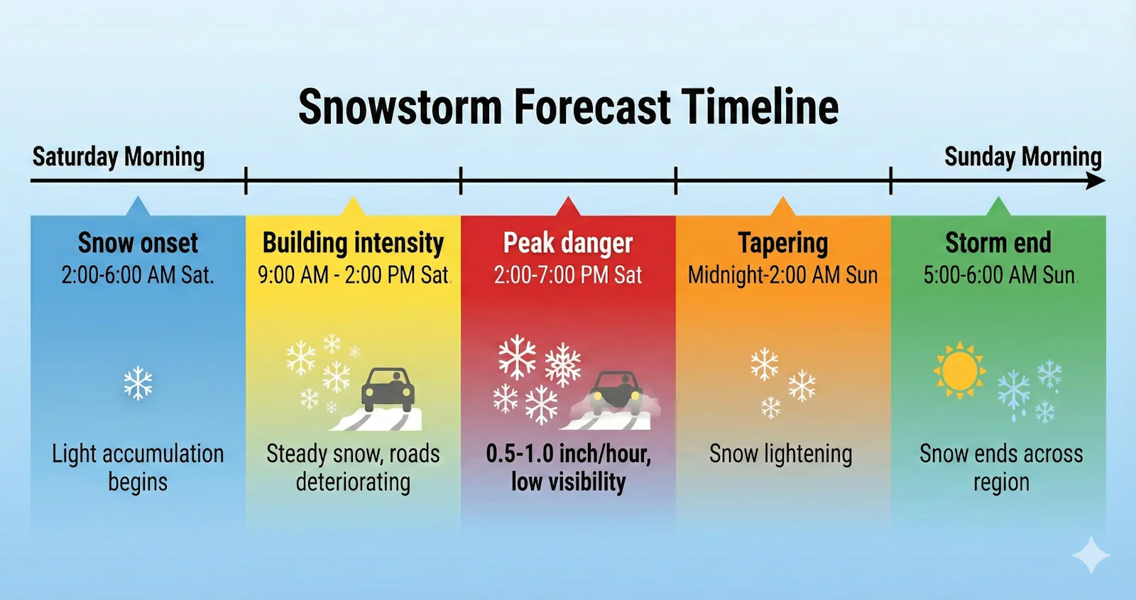
Storm Timing Creates a 12-Hour Critical Danger Window
The storm will move through in stages that give carriers time to plan.
| Phase | Timing | Conditions |
| Snow onset | 2:00-6:00 AM Saturday | Light accumulation begins |
| Building intensity | 9:00 AM – 2:00 PM Saturday | Steady snow, roads deteriorating |
| Peak danger | 2:00-7:00 PM Saturday | 0.5-1.0 inch/hour, low visibility |
| Tapering | Midnight-2:00 AM Sunday | Snow lightening |
| Storm end | 5:00-6:00 AM Sunday | Snow ends across region |
Post-storm northwest winds of 15-25 mph will continue creating blowing snow hazards into Sunday morning. Road clearing operations will prioritize interstates, with Wisconsin DOT expecting major lanes passable by late Sunday morning, roughly 6-8 hours after the snow ends.
Overnight temperatures will drop into the single digits and teens Sunday night, with Monday highs only reaching around 20°F. At these temperatures, road salt loses effectiveness, meaning treated surfaces can remain slick longer than during milder winter storms.
What Routes Are Affected By Wisconsin Winter Storm
The storm will strike the heart of Midwest auto transport operations, affecting primary north-south and east-west corridors.
I-94 Corridor (Chicago-Milwaukee) will take the hardest hit. This corridor, which normally sees over 150,000 vehicles a day, was buried under 6 to 10 inches of snow. With conditions worsening by the hour.
I-43 (Milwaukee-Green Bay) will present variable conditions due to lake effect activity.
I-41/Highway 41 experienced multiple semi-truck incidents during the smaller November 21 storm, including jackknifed trucks and a complete closure of northbound lanes near North Avenue.
I-90/I-94 Junction (Madison Area) expects 6-9 inches. Multiple communities surrounding this junction such as Stoughton, McFarland, and Lodi have declared snow emergencies
How This Storm Affects Auto Transportation
Winter storms create operational challenges that extend beyond the storm itself. Federal regulations require drivers to cease operations when conditions become “sufficiently dangerous,” and carriers who suspend operations create a significant backlog when they resume.
The Capacity Crunch
Since auto transport operates on continuous flow when a storm shuts down operations for 12-24 hours, vehicles don’t stop accumulating. Auction facilities, dealerships, and private sellers continue posting vehicles for transport, but the carriers who would normally handle those shipments are either parked waiting for conditions to improve or rerouted on longer paths.
When weather clears, carriers face roughly double their normal workload. A typical Saturday might have 50 carriers servicing the Chicago-Milwaukee corridor. If weather grounds those carriers for a full day, Sunday brings not just Saturday’s normal volume but also Friday evening’s backlog and Sunday’s new orders all competing for the same number of trucks.
How Auto Transport Pricing Changes After Weather Events
When demand exceeds supply, carriers naturally serve the highest-value customers first.
For example, a carrier with 10 vehicles waiting doesn’t pick them up in booking order, but carrier evaluates the rate offered for each load, pickup and delivery locations, and how each fits with other vehicles already scheduled.
The customers usually offer $100-$500 above the original quote for immediate pickup and the customer insisting on the original quote waits.
As a result this creates sudden rate increases and customer quoted $800 before the storm may agrees at $900-$1,300.
At Tempus Logix, we usually offer our customers the option to wait until carrier availability returns to normal and rates drop back to previous levels.
However, when a customer needs the shipment ASAP, we have no choice but to negotiate a new deal with the carrier for the best possible price so our customers can avoid being overcharged.
See also: Why Do Car Transport Carriers Charge 50-100% More During Thanksgiving Week?
The Timeline
Pricing effects typically last 3-5 days after a significant winter storm. Customers booking in the days immediately following major weather often pay 15-50% more than pre-storm rates.
Driver Hours Constraints
While Wisconsin didn’t issue a formal commercial-vehicle ban, drivers can only drive 11 hours within a 14-hour window before taking a mandatory 10-hour break.
A driver who spends Saturday parked waiting out weather doesn’t “save” those hours. If Sunday brings three hours of slow traffic on recently cleared roads, the driver gets only eight hours of productive driving instead of the usual 10-11.
Related: 8 Expert Trucker Tips for Driving on Frozen Roads in Winter
Conclusion
For this weekend’s Wisconsin storm, the realistic timeline will be a 24-48 hour delay for vehicles already in transit and a 2-4 day delay for vehicles awaiting pickup due to post-storm backlog and capacity constraints.
Book shipments early when possible to lock in pre-storm rates. When a storm is forecast, expect delays of 24-48 hours for vehicles in transit and 2-4 days for vehicles awaiting pickup.
Customers with time-sensitive shipments may need to pay premium rates for priority service during the post-storm capacity crunch.


