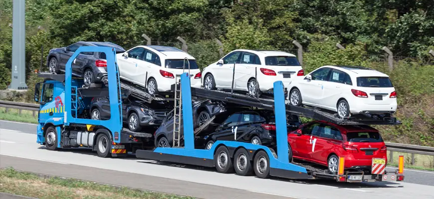
The USA is a country with a vast area, so people in the USA often need to transport their cars, motorcycles, bikes, and vehicles from state to state all over the USA safely. You don’t need to waste your time and nerves on searching, as the professional team of Tempus Logix is here to help you send your cars, motorcycles, bikes, and vehicles from Florida to Ohio.
You can contact Tempus Logix through live chat on the website or call +1(818)942-7030.
From Illinois (IL) to Ohio (OH) the driving distance is 378 miles / 608 km
Illinois
Illinois is the Midwest region of the United States, and is located in Illinois and ranks sixth in terms of population and 25th in area. Chicago is the largest city in Illinois and the fifth-largest city in North America. The capital of Illinois is Springfield, located in the state’s center; other major metropolitan areas include Metro East (Greater St. Louis), Peoria, and Rockford.
- Illinois has a very diverse economy.
- The state is a central transportation hub: the Port of Chicago has access to the Atlantic Ocean via the Great Lakes, St. Lawrence Island, and the Gulf of Mexico from the Mississippi River via the Illinois waterway. The Mississippi, Ohio, and Wabash rivers form part of the state’s borders.
- O’Hare International Airport has been one of the top 10 busiest airports.
- It has a humid continental climate (Köppen climate classification Dfa) with hot summers and cold winters.
- In Chicago, there was built the first nuclear reactor. Illinois has six nuclear power plants: Braidwood, Byron, Clinton, Dresden, LaSalle, and Quad City.
- Aurora is a satellite city of Chicago and the second-most populous city in Illinois.
- Located in Winnebago County in the north-central part of Illinois, Rockford is the state’s third-biggest city.
- Joliet, located in metropolitan Chicago, is the fourth largest city in the state, with a population of 147,433.
- Naperville, a Chicago suburb, ranks fifth with 141,853 residents. Naperville and Aurora share a common boundary along Illinois State Highway 59.
- Springfield, the state capital, is the sixth most populous city with a population of 117,352.
- Peoria, the second-most populous city in the state decades ago, ranks seventh with 115,007 people.
- The eighth-largest city is Elgin, a northwestern suburb of Chicago with a population of 108,188.
Some interesting info about Ohio State
- Ohio – is in the Midwestern region of the U.S.
- It is the 34th-largest by area; the population is nearly 11.8 million.
- Ohio State is the seventh-most populous and tenth-most densely populated.
- Lake Erie borders Ohio to the north. Pennsylvania borders to the east, West Virginia to the southeast, Kentucky to the southwest, Indiana to the west, and Michigan to the northwest.
- Columbus is the capital and largest city, with the Columbus metro area, Greater Cincinnati, and Greater Cleveland is the most significant metropolitan area.
- The state is known as the “Buckeye State” for its Ohio buckeye trees, and Ohioans are also known as “Buckeyes.”
- The Ohio flag is the only non-rectangular flag of all the U.S. states.
- The state’s name comes from the River Ohio, which originated from the word ohiːyo’, meaning “good river,” “great river,” or “large creek.”
- Being a contributing anchor for the region Ohio called the “Green Belt,” of the growing renewable energy sector, Ohio had also nicknamed the “fuel cell corridor.”
Humid continental climate features of Ohio
- Summers are hot and humid, but winters generally range from excellent to cold.
- Precipitation in Ohio is moderate year-round.
- Severe lake effect snowstorms are on the southeast shore of Lake Erie.
- Severe weather is also not uncommon in the state.
There are fewer tornado reports in Ohio than in states located in what is known as the Tornado Alley.
Ohio has developed a network of roads and interstate highways:
- I-80/I-90 Ohio Turnpike
- I-76 From Akron to Pennsylvania,
- I-70 Columbus, Dayton, and the Appalachian Highway (State Route 32) run from West Virginia to Cincinnati.
North-south routes:
- I-75 linking Toledo, Dayton, and Cincinnati,
- I-71 the middle of the state from Cleveland through Columbus and Cincinnati into Kentucky,
- I-77 in the eastern part (Cleveland through Akron, Canton, New Philadelphia, and Marietta south into West Virginia).
- A large amount of east-west transportation corridors go through Ohio. One of those leading routes, known as “Main Market Route 3”, was chosen in 1913 to become part of the historic Lincoln Highway, the first road across America, connecting New York City to San Francisco. The Lincoln Highway connected many towns and cities in Ohio, such as Canton, Mansfield, Wooster, Lima, and Van Wert.
- The arrival of the Lincoln Highway to Ohio was significant. The Lincoln Highway through Ohio became U.S. Route 30.
It is home to 228 miles (367 km) of the Historic National Road, now U.S. Route 40.
Ohio has long-distance hiking trails, the most prominent of which is the Buckeye Trail which extends 1,444 mi (2,324 km).
Ohio has extensive railroads, though most are only utilized by freight companies today.
- The biggest cities in the north and south of Ohio lie on Amtrak intercity rail lines.
- Interstate 75 (linking Cincinnati and Dayton) is one of the congested highways.
- In total, 8 Ohio airports offer commercial, year-round flights, and the rest handle only domestic and regional flights.
The states in which we operate
- Alabama
- Alaska
- Arizona
- Arkansas
- California
- Colorado
- Connecticut
- Delaware
- Florida
- Georgia
- Hawaii
- Idaho
- Illinois
- Indiana
- Iowa
- Kansas
- Kentucky
- Louisiana
- Maine
- Maryland
- Massachusetts
- Michigan
- Minnesota
- Mississippi
- Missouri
- Montana
- Nebraska
- Nevada
- New Hampshire
- New Jersey
- New Mexico
- New York
- North Carolina
- North Dakota
- Ohio
- Oklahoma
- Oregon
- Pennsylvania
- Rhode Island
- South Carolina
- South Dakota
- Tennessee
- Texas
- Utah
- Vermont
- Virginia
- Washington
- Washington DC
- West Virginia
- Wisconsin
- Wyoming


